 |
||
08/22/08 |
|
|
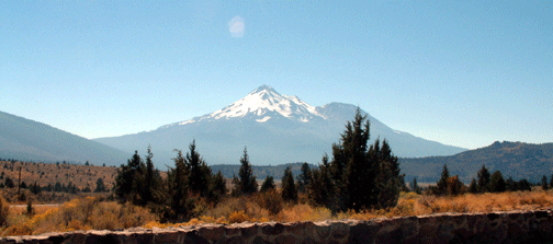
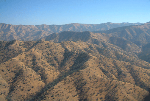
September 28, 2005 Moments after leaving Chiloquin the flight became very dramatic as I flew right over Hiway 97 which is sandwiched between the edge of Upper Klamath Lake and the mountain wall of 6,551' Modoc Point. The mountain was only 100' off my left side while the lake was 30' off my right side. After I rounded the south end of the lake I scouted the terrain to the west on a direct line towards my next stop but it was very heavily timbered so I resolved to play it safe and follow the road on its more round about course. This proved to be a lucky break because while the road required me to fly higher, again above the 6,000' level it rewarded me with breathtaking views of Mt. Shasta directly ahead. As I neared Shasta the road turned to circle the mountain on its western slopes. For nearly 30 minutes I flew along with this majestic 14,162' monolith just off my rotor tips. Much to my chagrin I had not carried the camera with me since the accident and now I regretted it, but fortunately Dee stopped in the motorhome and took a few pictures of this dramatic peak. At my next stop in Weed I chanced to meet a Shasta climbing guide who explained what makes Shasta look so dramatic. In Colorado where I am from we have over 50 mountains over 14,000' but most rise up from terrain that is already at 10-12,000'. Shasta on then other hand rises from terrain that is less than 3,000' giving it a vertical rise of 11,000'. It appears much like 20,320' Mt. McKinley (Denali) in Alaska which I had climbed a few years previously. Further conversations with the local climbing guide revealed we had many friends in common in the climbing community. From Weed I was again into the higher elevations and following a narrow road sandwiched between mountain ridges on both sides. In these conditions I fly much higher above the ground than normal but still endeavor to stay below the ridges where the air is smoother. Slowly the tight mountains gave way to the high mountain lake of the Shasta National Recreational Area and on the other side of the lake the land dropped down to the lower elevations of the Central Valley of California. I pulled the power back to half throttle and let the gyro glide on down towards the green fields outside of Redding California. From here it was just a short cruise to the small airport at Red Bluff where Dee was waiting for me.
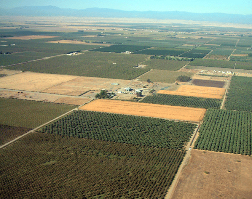
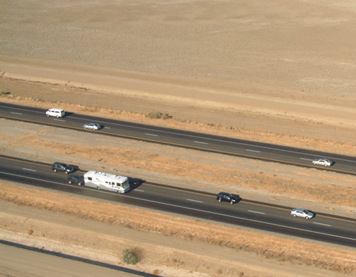
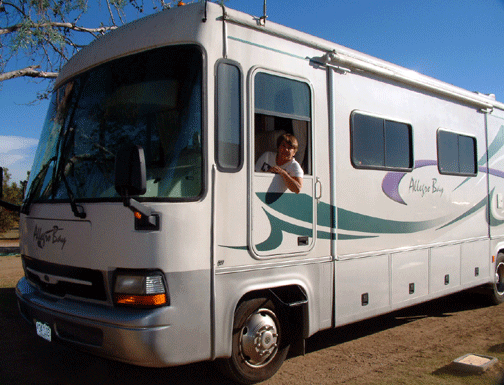
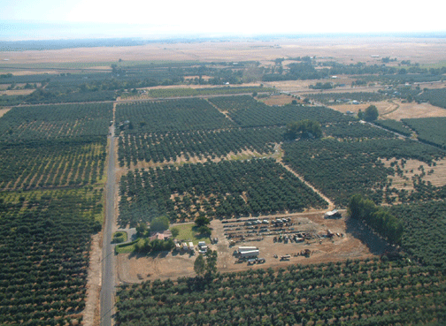
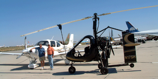
September 29, 2005 I lift off from Red Bluff finally relaxed and comfortable with the new SparrowHawk gyroplane. The first days flying in this new machine had been over difficult terrain and that coupled with my nervousness took some of the fun out of the trip but today I was at low altitudes over open fields and I began to enjoy myself more. It was hard to feel as relaxed in this machine in which I had only flown a few hours compared to my gyro in which I had spent over 200 hours and made hundreds of landings. But the truth of the matter was that Randy's SparrowHawk flew more smoothly than mine and the larger and heavier cabin felt much more substantial. My first flight today is a hop of 100 miles to Davis, California where I am having lunch with a high school friend who is a professor at the University there. The airport is very quiet when I land but the nearby college town is hoping with activity. From Davis I'm again airborne over fields, orchards and vineyards all irrigated by the canals running through the otherwise dry terrain. Occasionally a dust devil will be whipped up by the thermals rising but the day is completely flat calm with rarely a puff of wind rippling the crops. I have not seen a cloud in days and the sky is a bright blue as I continue south to meet Dee in Tracy, California. September 30, 2005 We had intended to fly to Bakersfield today but our plans were soon to change. About 15 minutes after take-off I felt the gyro roll slightly to its side momentarily. It was only a millisecond but it was a motion I had never felt a gyro make before so it concerned me and I paid very close attention to everything for the next few minutes. All engine gauges were normal and there was no indication of anything unusual in the rotor controls so I flew on. Twenty minutes later everything was normal and I was relaxed again. I switched the radio to the frequency for Los Banos airport which I was passing and made an announcement that I was in the area and flying southwards. A training helicopter was northbound so he and I spoke on the radio a moment to clarify where we each were so there was no hazard. No sooner had I finished my conversation with him than the gyro rolled again to one side and the engine seemed to cough momentarily. It was only a microsecond and happened so fast that I was not even sure which way the gyro had rolled or if the engine had really sputtered but it was enough to cause alarm. I quickly pushed the buttons on the GPS to guide me directly to the Los Banos airport and made a radio call to alert others that I would be landing immediately. I came straight in to a smooth landing and was quickly surrounded by 4 or 5 mechanics who work on the Silver State Helicopter fleet based here. They were fascinated by the gyro and when I told them of my engine sputtering they quickly dived in to help. We did not see anything obviously amiss on the engine so they helped me drain the fuel and strain it before putting it back in. They also took me into town where we obtained new fuel filters which we installed. The gas and old filters both had some dirt in them so we hoped that was the problem. I alerted Dee to the delay and we made a plan for a shorter day then I took off and circled the airport for 10 minutes while the engine purred along sweetly. When I felt confident enough I left the airport area and continued on my way south with no further problems. Two hours passed with no problems and just as I neared the Lost Hills airport I saw Dee below me on the highway. This was one of only a handful of times we've seen each other so I took several photos before flying on ahead. The Lost Hills airport was certainly one of the most desolate airports I had visited on my entire trip. It was broiling hot so I sat in the shade of the gyro and waited for Dee to arrive.
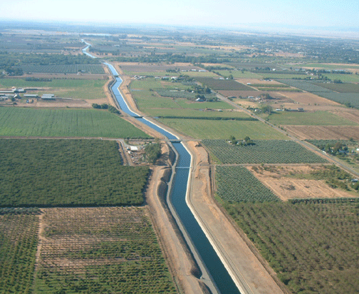
October 1, 2005 Mohave has a reputation for very strong winds with 50 knots being not uncommon. It is usually calmest first thing in the morning so it was good that I had an early start and not too far to go today. I climbed rapidly out of Lost Hills and the terrain was much like the day before with fields and orchards below me interspersed with a canal or water pipe carrying precious irrigation water to the otherwise barren fields. Near Bakersfield the visibility went down to about 5 miles in haze but I thought it would improve farter along my route. Flying East from Bakersfield the land is flat for the first few miles then it rises very steeply into the mountains. Bakersfield is at only 375 feet while Tehachapi 30 miles away is at 4,000 feet. I put on the power and timed my climb to match the landscape staying at least 1,500 feet above the ground the entire time. My route followed the road and I was flying in a narrow gap between mountains. In one spot I passed a train which looked like a silver snake below me as it wound through the hills and went inside a tunnel. At the top of the climb the landscape opened out near Tehachapi. Up ahead of me I began to see hundreds and hundreds of windmills lining nearly every foot of the ridge lines. Logic tells me they only build windmills where there is wind so I was prepared for some buffeting but it seemed to be my lucky day as I flew past several ridges with no problems at all. Just when I began to think I was home free the road and my route through the mountains took a sharp bend to the north and the gyro began bucking and kicking in the severe drafts. I had no choice but to hang on tight and try my best to be gentle with the machine so as to not overstress the gyroplane. Fortunately only 2 miles farther on the road made another sharp bend and then opened out to the south and there sat Mojave airport in the high desert valley below. I landed behind some sort of military looking jet and taxied to the ramp where I learned there were half a dozen privately owned ex-military jets here for a fly-in. My brother had decided to fly up to Mojave in his Cirrus SR-22 to join me for lunch so we spent the next few hours at the airport talking with the jet pilots and enjoying the scene from the restaurant overlooking the ramp.
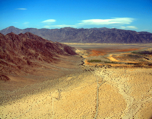
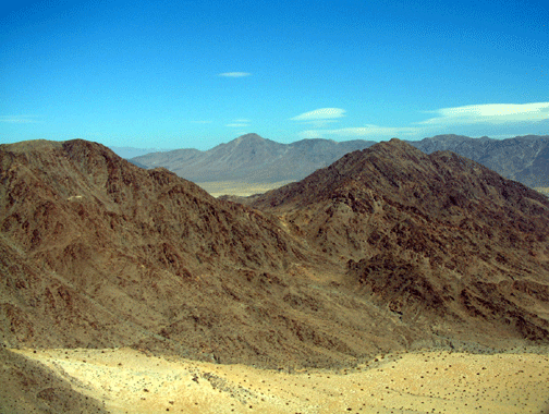
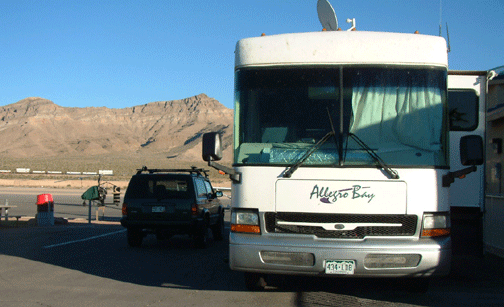
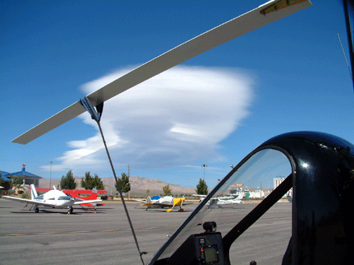
October 2, 2005 Up early again for departure before the winds pick up. I taxi across the ramp to see the hangar of Scaled Composites - the company owned by Burt Rutan, an aircraft designer with no peers. His most recent in a long line of accomplishments was winning the 10 Million dollar X prize for putting a manned rocket into outer space twice within a 10 day period. Today is Sunday so no one is about but all the locals tell me Burt is just a regular guy around the airport. My first leg is to fly south about 20 miles out of my way to be clear of a restricted military operations area near Edwards Air Force Base. Flying here is interesting with the dry lake beds below me and nothing but desert in all directions. I'm in the middle of one of the most uninhabited areas when I see faint movement and color far in the distance. As I get closer this strange mirage reveals itself to be a group of moto-cross riders camped out in the middle of nowhere. My own engine noise is drowning out the hoarse bleat of their dirt bikes but their plumes of dust show me exactly where they are. My fuel stop is at Barstow where a very efficient FBO operator gives me the winds and tells me I'm the only airplane in the vicinity. My landing was fine glass smooth directly into the wind and when I taxi up to the fuel pump someone is already waiting to fuel the gyro and ask questions. The airport looks fairly large with lots of planes on the ramp but very few people about. After gassing me up the airport manager asks to take pictures of the gyro for their pictorial collection of unique aircraft. I'm enjoying a snack lunch and conversation with another pilot who is on one of his first cross-country trips in his 170 knot kit built hotdogger when the airport manager tells me my destination of Jean is always windy and will be especially bad with today's developing conditions. I quickly bolt down my remaining food and get airborne before things get much worse. I climb out then turn back and fly over to wave at the watchers on the ramp below, then it's a banked turn to the northeast to pickup Interstate 15 heading towards Las Vegas. The first dozen miles are fine then the terrain begins to climb an additional 1,000 feet up to Jean. As I climb the mountains close in creating a venturi that speeds up the wind and fortunately its a tailwind. My normal speed is 62 knots and now my GPS indicates 93 knots over the ground meaning I have a 31 knot tailwind. In this much wind my landing is more like a helicopter as I hover nearly motionless over the runway and keep reducing power until the tailwheel touches. My ground roll is no more than 6 inches and the touchdown is so smooth that it's impossible to tell the exact moment when I cease to fly and become ground bound again. It's Sunday afternoon and I have plenty of spectators on the ramp watching my miraculous landing. Most of them have flown to Jean or Las Vegas for the weekend and are now stuck here as none of them want to buck the headwinds which are 33 knots here and are nearer 50 knots towards Mojave. As if to make the point even more clear while we talk several lenticular clouds develop right over our heads. I took a photo on the ramp at Jean with a dramatic lenticular cloud hovering over the SparrowHawk. These lens shaped clouds are clear indications of severe winds in the mountains and all small plane pilots are taught to stay on the ground when they appear.
|
|


Home | Log 1- Arizona, New Mexico, Texas | Log -2 Louisiana | Log 3- Florida | Emergency Landing | Log 5- Georgia, So. Carolina | Log 6- North Carolina | Log-7 TN, KY, WVA | Log- 8 Virginia | Log-9 MD,PA,DE, NJ | Log 10- New York | Log 11 CN, RI, MA | Log 12 NH, ME, VT | Log 13- NY, OH, MI | Log 14- Indiana | Log 15- IL, WI, MN | Log 16- IA, KS, NE | Log 17- CO, WY & Dakotas | Log 18- Montana | Log 19- Idaho,Wash, Oregon | Log 20- California | Log 21- Nevada, Utah
This site was last updated 10/20/05